2024 Alaska Road Trip (Week 1)
This journal posting chronicles Week 1 (Sunday June 23rd - Saturday June 29th) of a road trip to Alaska and back with Diane, Kenny and Deneen.
Index for Week 1
Day 1: Sunday June 23rd - Eagle Haven Park, Sedro Woolley, WA
Day 2: Monday June 24th - Monck Provincial Park, Quilchena, BC
Day 3: Tuesday June 25th - North Thompson River Provincial Park, Clearwater, BC
Day 4: Wednesday June 26th - Beaverview RV Park & Campground, McBride, BC
Day 5: Thursday June 27th - Crooked River Provincial Park, Fraser-Fort George, BC
Day 6: Friday June 28th - Lions Flatbed Creek Campground, Tumbler Ridge, BC
Day 7: Saturday June 29th - Lions Flatbed Creek Campground, Tumbler Ridge, BC
Day 1 - Sunday June 23rd
Today is one of our longest travel days from home to a Harvest Host winery called Eagle Haven Winery where we are spending our first night camping. The goal is to cross the Canadian border tomorrow into British Columbia.
Since I am writing and updating this posting as we progress through the trip, the featured photo is likely to change until I take one that I feel best represents the trip.
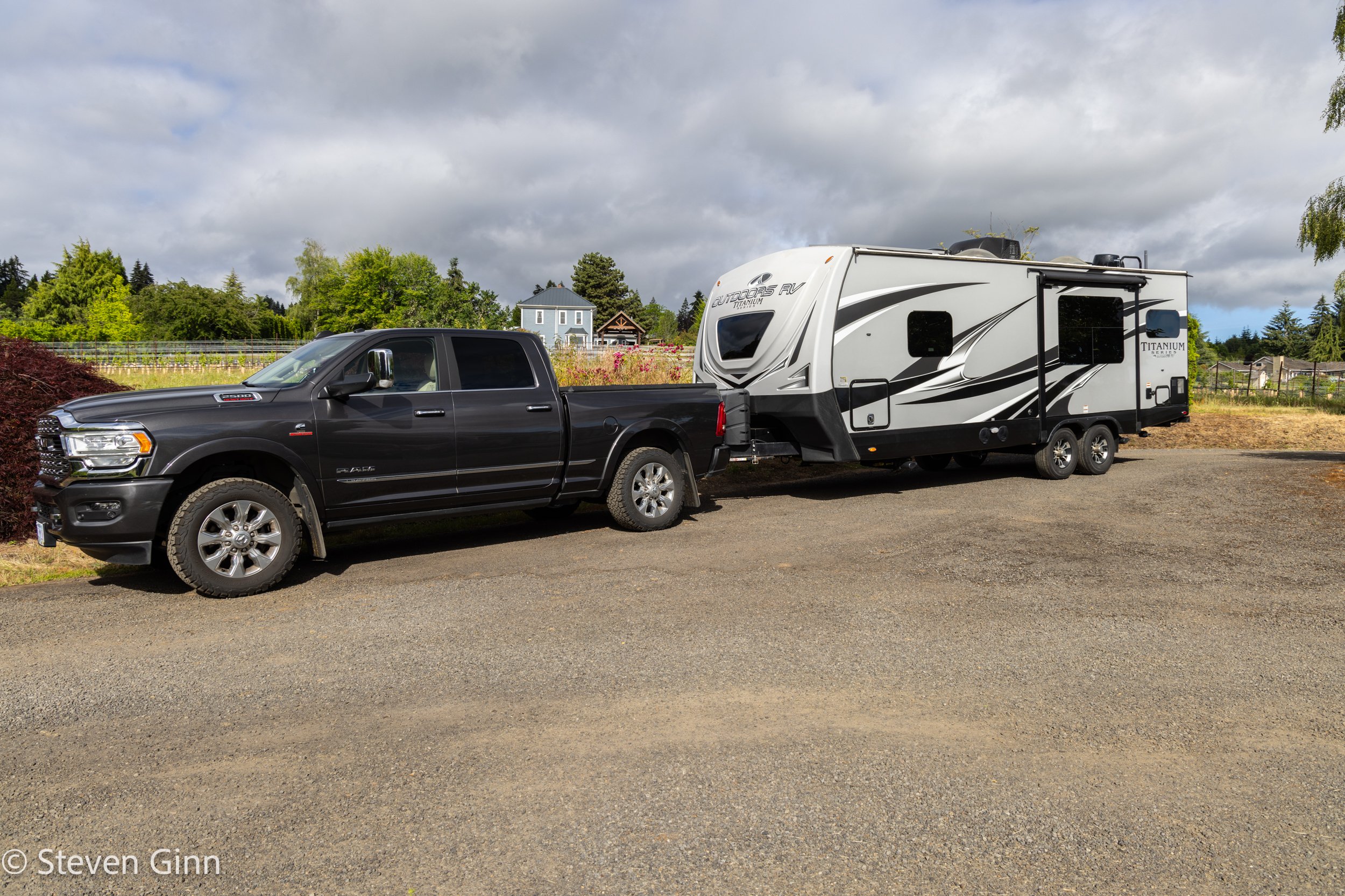
The first few images are of us as we prepare to leave on the trip. It has been a year and a half of planning for this trip. It is hard to believe we are actually underway!
All four of us will need to learn how to spend the next eight week in our home on wheels.
Just before leaving on the trip, Hillsboro, Oregon
We have two mascots with us, Snowball & Lucy.

Snowball & Lucy, Hillsboro, Oregon
Then there is the rest of us; Diane, Deneen, Steve and Kenny.

Snowball, Lucy, Diane, Deneen, Steve, and Kenny, Hillsboro, Oregon
Fortunately my pickup is pretty spacious inside.

Kenny, Snowball, Lucy and Deneen, Hwy 30, Oregon
Then there is me.
While I was driving, some of our friends were texting about us leaving on the trip, and apparently they came up with “The Book of Steve”, a reference to the large binder with all the planning material for this trip, including a detailed spreadsheet of all the stops.
The Book of Steve
1a In the beginning, God created camping… and Steve said it was good.
1b In the beginning, God created Excel… and Steve saw it was good.
2 On the second day, God created the three-hole punch and binder… and Steve saw it was good.
3 We skipped the third because Steve was filling the binder.
4 On the fourth day, God created Pinot Noir… and Steve said it was very good.
5 On the fifth day, God created the still… and Steve said that it was good.
6 11th Commandment; Thou shalt not deviate from the plan.

Steve, Hwy 30, Oregon
And of course Lucy and Snowball. Lucy was a little tired.

Lucy, Snowball, Hwy 30, Rainier, Oregon
After 280 miles we arrived at the Harvest Host Eagle Haven Winery in Sedro-Woolley, WA.
For those who don’t know the Harvest Host system, it is a program where wineries, breweries, farms, museums, etc sign up to allow RVs to stay on their property in exchange for a handshake agreement that the RV’ers will spend money at their property. There is also a small annual fee that the RV’ers pay to Harvest Hosts to be part of the program.
Below is is picture of the field that Eagle Haven Winery has the Harvest Host campers stay in. We were the only ones there. It was a very peaceful stay, and we enjoyed our time here.

Harvest Host parking at Eagle Haven Winery, Sedro-Woolley, Washington
Our contribution to the host was to do three wine tastings which Snowball tried to participate in.

Eagle Haven Winery, Sedro-Woolley, Washington
Kenny had a Diet Pepsi.

Eagle Haven Winery, Sedro-Woolley, Washington
Of course Snowball had to try the Pepsi as well.

Eagle Haven Winery, Sedro-Woolley, Washington
The funny thing was that as far as we could see Eagle Haven Winery only had apple trees, we did not see any grape vines.

Eagle Haven Winery, Sedro-Woolley, Washington
It was pleasant to walk around the property. Kenny took several walks and enjoyed them.

Eagle Haven Winery, Sedro-Woolley, Washington
The soil must have been almost all ash, look how gray it is.

Eagle Haven Winery, Sedro-Woolley, Washington
At least one of the horses took notice of me as I walked around.

Eagle Haven Winery, Sedro-Woolley, Washington
Day 2 - Monday June 24th
Today we drove from Eagle Haven Winery in Washington state to Monck Provincial Park in British Columbia, 186 miles/299 km.
We started tracking sunrise and sunset as we get farther north, today sunrise was 5:08 AM.
Before leaving this morning we noticed that one of the burners on the trailer’s stove had fallen off. It turns out that the screw holding the burner to the bracket had simply worked loose over time, easy fix.

Trailer Maintenance, Eagle Haven Winery, Sedro-Woolley, Washington
Our border crossing was very uneventful, the border agent looked at my spreadsheet itinerary and flagged us through with very few questions. :-)

Canadian Border Crossing, Sumas, Washington
We crossed the border with only basic stables for food due to some of the Canadian regulations for taking various fresh foods across the border. So our first stops in Canada were in Abbotsford (a very short distance from the border), at Costco, Walmart and Angry Otter Liquor Store.
After shopping we got back on the road, Trans-Canada Highway 1, and headed northeast towards our first night in Canada at Monck Provincial Park.
The drive along Trans-Canada Highway 1 was pleasant and scenic.

Fraser River & Mountains, Trans-Canada Highway (Hwy 1), British Columbia, Canada
After following the Fraser River northeast for some distance we turned north to Coquihalla Highway (Hwy 5). Which was also a pleasant and scenic drive.
I have always enjoyed the Snow Sheds, which are basically tunnels over the highway that protect it from snow avalanches.

Snow Shed, Coquihalla Highway (Hwy 5), British Columbia, Canada

Snow Shed Art Work, Coquihalla Highway (Hwy 5), British Columbia, Canada
The drive along Coquihalla highway was scenic with a variety of topography.

Coquihalla Highway (Hwy 5), British Columbia, Canada

Coquihalla Highway (Hwy 5), British Columbia, Canada
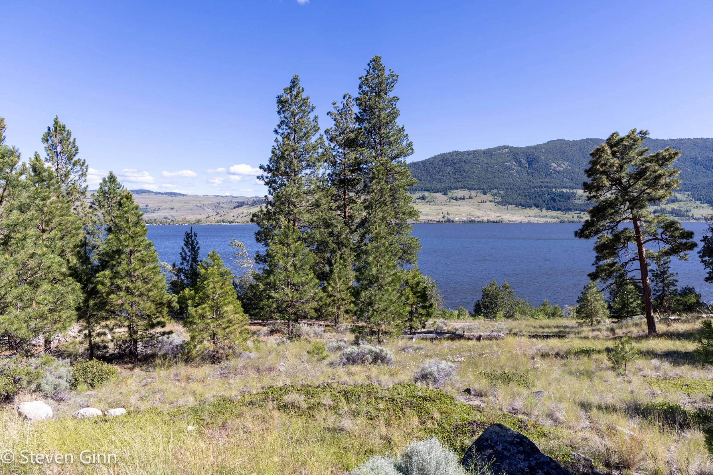
Our first night in Canada was Monck Provincial Park, which is located along the shore of Nicola Lake.

Nicola Lake, British Columbia, Canada
Snowball and Lucy enjoying the beautiful weather we had at Monck Provincial Park.

Snowball and Lucy, Monck Provincial Park, Nicola Lake, British Columbia, Canada
We had a very nice stay at Monck Provincial Park at site 11, which was very large and had a good view of the lake and an outstanding view of the sky for Starlink.
Diane is spending a pretty fair amount of time working while we are on this trip. Thanks to Starlink, as long as we have a reasonable view of the sky, she can work pretty easily. Below is a photo of her view from her trailer office, i.e. the dinette in the trailer.

View from inside trailer, Nicola Lake, British Columbia, Canada
Meanwhile the rest of us were enjoying the beautiful weather and scenery outside. Possibly with a cocktail or two for those of us not working (yes, you should feel sorry for Diane)…

Monck Provincial Park, Nicola Lake, British Columbia, Canada
Below is the view from the campsite.
Nicola Lake, British Columbia, Canada
Tonight’s sunset is: 9:17 PM
Day 3 - Tuesday June 25th
Sunrise at Monck Provincial Park was: 4:45 AM
Today we drove 143 miles/230 km from Monch Provincial Park to North Thompson River Provincial Park. After that we arrived at camp and set it up we drove into Wells Gray Provincial Park for and additional 103 miles/167 km. So today’s total mileage was 246 miles/397 km.
Diane noticed this morning that even this far south in Canada that the bugs are already getting big!
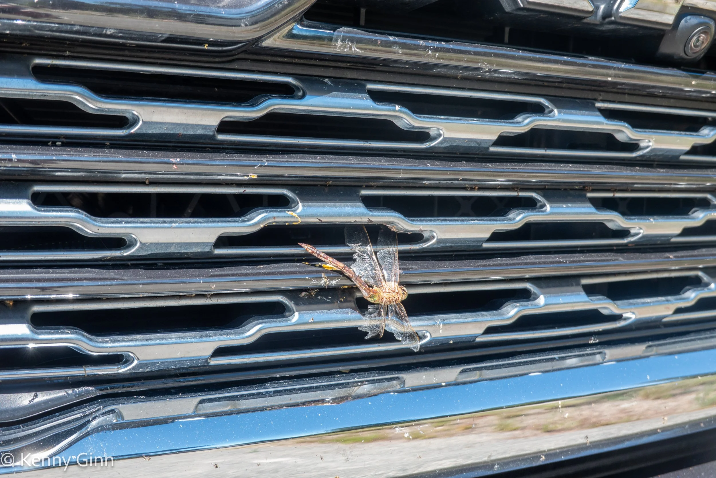
Collecting large bugs in Canada, what will it be like in Alaska?
Below is a photo of last nights campground entrance, I’m glad we didn’t meet the real life version of that squirrel overnight.

Monck Provincial Park Sign, Nicola Lake, British Columbia, Canada
A view of Nicola Lake as we headed north on the Coquihalla Highway (Hwy 5).
Nicola Lake, British Columbia, Canada
As we continued to head north we started to see mountains with snow on them.

Coquihalla Highway (Hwy 5), British Columbia, Canada
After passing Kamloops, while we remained on Hwy 5 the highway name changed to the Southern Yellowhead Highway.
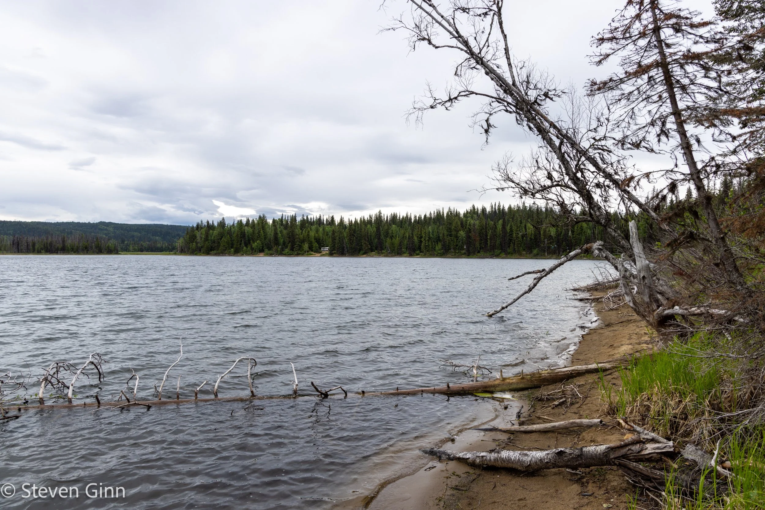
We had a great campsite that literally backed up to the North Thompson River. We put all the tire chocks behind the wheels so the trailer would not roll back into the river when we unhitched.

North Valley River Provincial Park, British Columbia, Canada
Once our camp was setup, and Diane did some work, we hopped into the pickup and drove into the Wells Gray Provincial Park all the way up to Clearwater Lake. This was an additional 103 miles/167 km for the day.
There were some interesting sites along the way, such as this rather large creek we drove over on a single lane wooden bridge. A little over half way out to Clearwater Lake the road turned to dirt, but was well maintained so we kept going.

Myrtle River, Wells Gray Provincial Park, British Columbia, Canada
Below is a photo of a small part of Clearwater Lake looking south from the small boat ramp and dock. The main body of the lake was around a corner to the north that we could not see, nor drive to, from here.

Clearwater Lake, Wells Gray Provincial Park, British Columbia, Canada
Snowball took a little time out to rest out on the small dock at Clearwater Lake.

Snowball, Clearwater Lake, Wells Gray Provincial Park, British Columbia, Canada
A short way back down Clearwater Valley Road on our way back, we stopped at Shadow lake for a nice view of what we think was Azure Mountain, but we are not a hundred percent sure.

Shadow Lake, Wells Gray Provincial Park, British Columbia, Canada
As we were driving back, we saw an American Martin (similar to, but not the same as a Pine Marten).
There were also some nice wild roses.

Wild Roses, Shadow Lake, Wells Gray Provincial Park, British Columbia, Canada
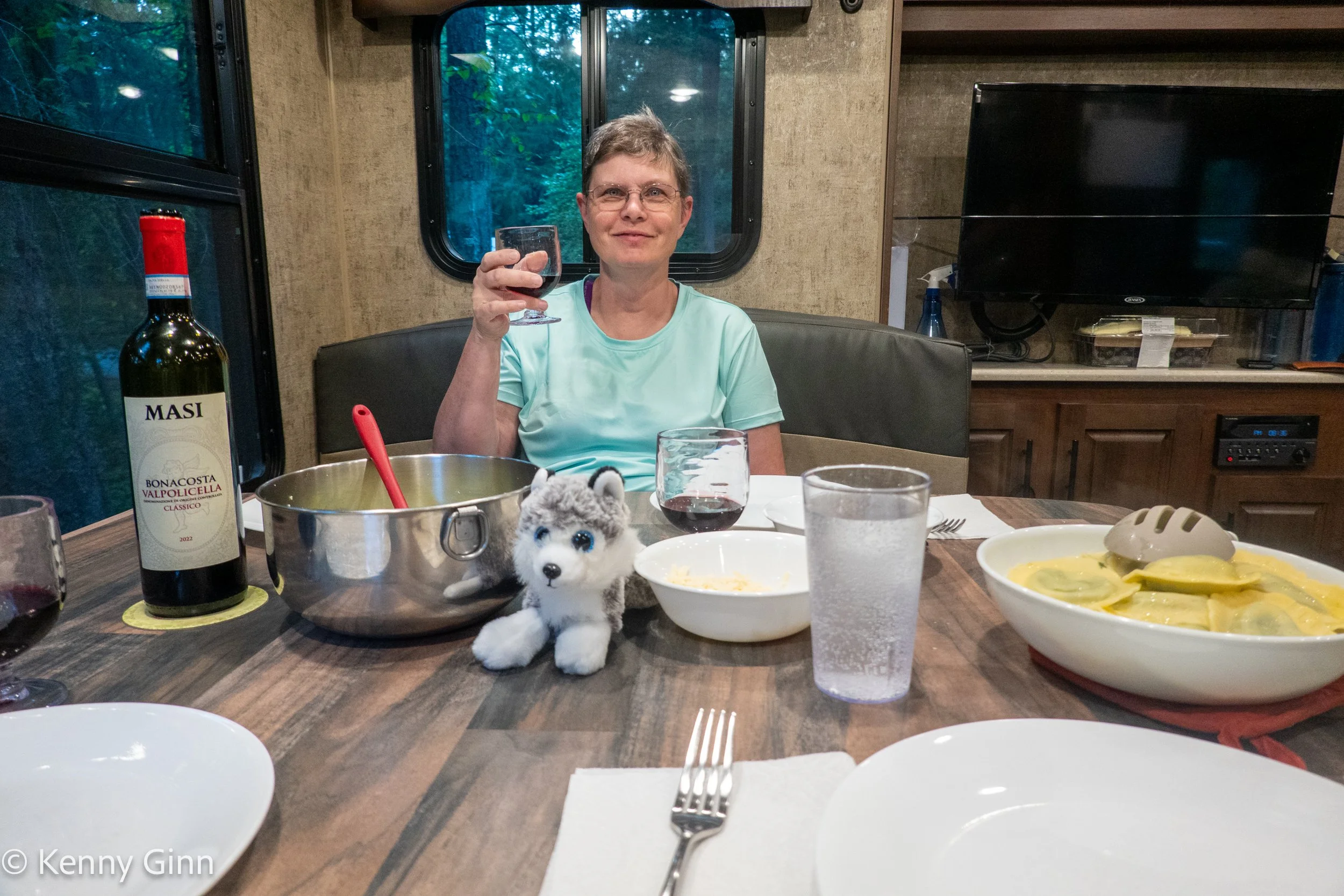
Deneen and Lucy looking forward to eating our spinach and ricotta cheese ravioli and caesar salad. We were planning on pork chops but by time we returned from Wells Gray Provincial Park we decided to go with a shorter prep time meal.
North Thompson River Provincial Park, Clearwater, British Columbia, Canada
Tomorrow we head northwest to our first RV Park of the trip, Beaverview RV Park near McBride, BC.
Sunset at North Thompson Provincial Park was: 9:32 PM.
Day 4 - Wednesday June 26th
Today we drove 179 miles/288 km from North Thompson Provincial Park to Beaverview RV Park.
Sunrise at North Thompson Provincial Park was at 4:44 AM.
Our goal today was just to make tracks father north and get into the RV park in time to do our first load of laundry.
It was a scenic drive and I especially like the statue of a grizzly bear with two cubs on top.

Southern Yellowhead Highway (Hwy 5), British Columbia, Canada
We keep seeing signs for moose, but have yet to see one. However we did see a couple black bears today, which was a lot of fun. But unfortunately we sped past before we could get a photo.

Southern Yellowhead Highway (Hwy 5), British Columbia, Canada
After traveling north on the Southern Yellowhead Highway (Hwy 5) we came to Hwy 16, known as the Yellowhead Highway (note the missing “Southern”) and headed west towards Beaverview RV park.
Beaverview RV park was very nice, more people showed up after the photo below, but they spread everyone out with a space in between. It had real showers and a laundry room.

Beaverview RV Park, McBride, British Columbia, Canada
Snowball and Lucy enjoyed a relaxing time on the trailer steps after a stress free drive today.

Beaverview RV Park, McBride, British Columbia, Canada
As it turns out, most of the photos taken by the small point & shoot camera, thanks Ben, have been actually taken by Diane. But some are taken by Kenny, as exampled below. As of this post I have started copyrighting them by Diane.

Beaverview RV Park, McBride, British Columbia, Canada
Below is a view across the Fraser River looking at the Cariboo Mountains Provincial Park from the RV park. Interestingly, just south of the Cariboo Mountains Provincial Park is the Wells Gray Provincial Park which we visited yesterday.

Beaverview RV Park, McBride, British Columbia, Canada
Dinner of Diane’s sour cream panko crusted chicken breast… very good.

Beaverview RV Park, McBride, British Columbia, Canada
Lucy thought so as well.

Beaverview RV Park, McBride, British Columbia, Canada
Sunset today at Beaverview RV park will be at 9:32 PM
Our goal is to head farther north tomorrow!
Day 5 - Thursday June 27th
Despite it raining hard all night long, and a good portion of the day, we made good progress, driving 183 miles/295 km from Beaverview RV park to Crooked River Provincial Park, by way of Prince George. Sunrise at Beaverview RV park was 4:35 AM.
The clouds and rain during the day made for a lush green drive through some very remote roads.

Yellowhead Highway (Hwy 16), British Columbia, Canada
Along the way we saw more black bears and some beaver dams. But we still have not been able to get a photo of a black bear.
There was a nice view of Prince George as we approached it after a long drive on a road that felt like the middle of nowhere on a wet and rainy day.

Yellowhead Highway (Hwy 16), British Columbia, Canada
Once we reached Prince George, and before we headed north to Crooked River Provincial Park for the night, we had two important stops to make. First, we needed fuel for the truck, and second we needed some higher octane fuel for the ladies and I.
While we started the trip with a reasonable amount of bourbon, the two ladies and I have been enjoying it, so we were in need of additional supplies before we ran out.
So we picked a gas station next to a liquor store. It turns out that the liquor stores in Prince George have a very limited stock of bourbon. Diane was texting me the options from this particular store while I was fueling the truck. Fortunately they had Knob Creek.

Prince George, British Columbia, Canada
Upon leaving Prince George we headed straight north on the John-Hart Highway (Hwy 97). The road conditions deteriorated a bit, but were still pretty good, and in places very good.
Upon reaching Crooked River Provincial Park, we pulled into our very large site, and proceeded to set up, and at the same time the mosquitoes proceeded to get filled up on our blood.
The mosquitos were very thick and appear to be very attracted to the diesel exhaust of the pickup. But we have all been taking an antihistamine in anticipation of lots of mosquitos… so life is good.

Crooked River Provincial Park, Bear Lake, British Columbia, Canada
Crooked River Provincial Park must be a very popular park when it’s warmer and the mosquitoes have gone away, there was a “lot” of day use parking, all of which was empty.
The park surrounds Bear Lake (it should have been named Mosquito Lake).
Crooked River Provincial Park, Bear Lake, British Columbia, Canada
We had an excellent dinner of pork chops, orzo with onions and mushrooms, and a spinach salad. While our Starlink internet connection worked great out here in the middle of nowhere, the less said about the broadcast it allowed us to steam, shown in the background of the photo below, the better.

Crooked River Provincial Park, Bear Lake, British Columbia, Canada
Since we had a new bourbon, Lucy had to get in on the game.

Crooked River Provincial Park, Bear Lake, British Columbia, Canada
Snowball was interested in doing a side by side comparison.

Crooked River Provincial Park, Bear Lake, British Columbia, Canada
Finally, Kenny got a game of UNO with Snowball and Lucy looking on.

Crooked River Provincial Park, Bear Lake, British Columbia, Canada
Sunset at Crooked River Provincial Park this evening was 9:50 PM
Day 6 -Friday June 28th
Sunrise at Crooked River Provincial Park was 4:38 AM. We will head north for 205 miles/331km to Lions Flathead Creek Campground in Tumbler Ridge, BC today.
Before leaving, another look at Bear Lake revealed a Red-Necked Grebe enjoying the water.

Red-Necked Grebe, Crooked River Provincial Park, Bear Lake, British Columbia, Canada
Once we had breakfast and the campsite packed up, we went to the campground’s RV Dump station to empty our waste tanks and get potable water into our fresh water tank.
The water pressure on the potable water supply was pretty low, and even lower after going through my filters, so it took a long time to fill the fresh tank. Meanwhile, Diane wandered around taking photos.

Canadian Bunchberry, Crooked River Provincial Park, Bear Lake, British Columbia, Canada
Once we got back on the road we headed north along the John-Hart Highway (Hwy 97) and enjoyed some scenic views along side the highway.

Old Friend Mountain, John-Hart Highway (Hwy 97), British Columbia, Canada
Below was a particularly striking ridge line in front of us.
Murray Ridge, Pine Le Moray Provincial Park, John-Hart Highway (Hwy 97), British Columbia, Canada
While we have seen several black bears, we had not yet been able to get a photograph of one. That changed today as we came upon a very curious black bear standing up and watching us. It finally ran away as we slowly got closer.

Lemoray, John-Hart Highway (Hwy 97), British Columbia, Canada
In Chetwynd we stopped for fuel before we turned south on Don-Phillips Way (Hwy 29) to head towards Tumbler Ridge, according to Gas Buddy there is no Diesel in Tumbler Ridge.
Chetwynd has a lot of chainsaw carvings throughout town. The original carvings were the result of a larger 50th anniversary of the Alaska Highway that Chetwynd participated in. The Alaska Highway starts in Dawson Creek. While Chetwynd is close to Dawson Creek it is not actually on the Alaska Highway.

Artwork in Chetwynd, John-Hart Highway (Hwy 97), British Columbia, Canada
The little sign under the carving below is titled “Dinner for Two”, so naturally Lucy and Snowball wanted in on the action, and Kenny is not one to be left out when dinner is talked about.

Artwork in Chetwynd, John-Hart Highway (Hwy 97), British Columbia, Canada
Upon arriving at our campground, Lions Flatbed Creek Campground, in Tumbler Ridge, we had one of the tightest spots so far to get into. The campsite itself was large enough for us, but it was a right angle turn into it and only a very narrow road with a ditch on multiple sides to make that turn with. But with excellent help from my passengers we made it in only two tries. The camp host told me that he was impressed that we made it in, earlier a fifth wheel of similar length to us was not able to do it.

Lions Flatbed Campground, Tumbler Ridge, British Columbia, Canada
The campsite after we were set up.

Lions Flatbed Campground, Tumbler Ridge, British Columbia, Canada
Below is an image of Cottonwoods next to Flatbed Creek. For the last several days we have seen a “lot” of Cottonwood seeds floating around most of everyday, looking like it was snowing.
Note how dark chocolate brown the creek is, many of the creeks and rivers we have seen have been this color.

Flatbed Creek, Lions Flatbed Campground, Tumbler Ridge, British Columbia, Canada
Tonight’s dinner, lamb chops, mashed potatoes and peas.

Lions Flatbed Campground, Tumbler Ridge, British Columbia, Canada
The pups are into the bourbon again tonight.

Snowball and Lucy, Lions Flatbed Campground, Tumbler Ridge, British Columbia, Canada
Sunset in Tumbler Ridge today was 9:47 PM.
Day 7 - Saturday June 29th
Our plan is to spend two nights at Lions Flatbed Campground in Tumbler Ridge. Sunrise this first morning was 4:28 AM.
First up for the day is to drive an hour and a half out a long gravel road to Kinuseo Falls in Monkman Provincial Park. It was hard to see from the road, but the first part of the drive went past a very large coal mining operation.

Murray River Forest Service Road, British Columbia, Canada
Upon reaching the Kinuseo Falls, they had a convenient platform to view the falls from above.

Viewing platform, Kinuseo Falls, Monkman Provincial Park, British Columbia, Canada
The Murray River heading towards the falls was very fast and rough.

Murray River immediately above Kinuseo Falls, Monkman Provincial Park, British Columbia, Canada
We did a short hike up to a higher viewing area for an awesome view of Kinuseo Falls.
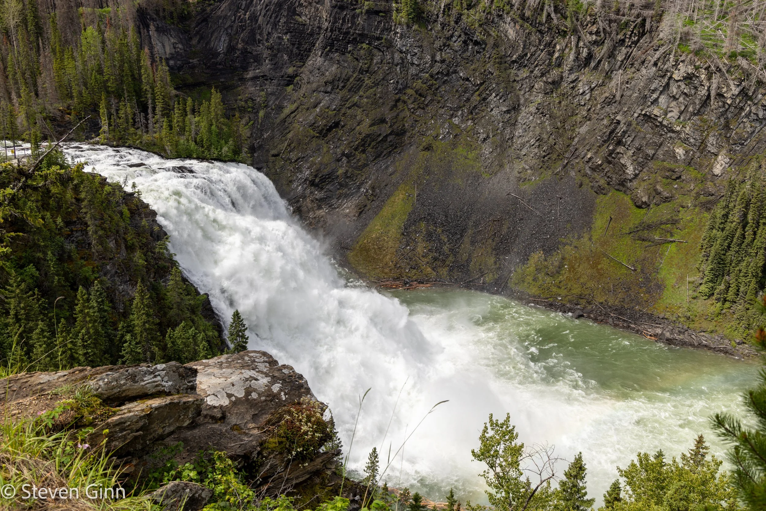
Kinuseo Falls, Monkman Provincial Park, British Columbia, Canada
Diane was able to capture a rainbow in the falls.

Kinuseo Falls, Monkman Provincial Park, British Columbia, Canada
Kenny had his own unique image of the falls that incorporated some foreground elements.

Kinuseo Falls, Monkman Provincial Park, British Columbia, Canada
Below the falls was the beautiful Murray River leading off into the distance. We saw a couple tour jet boats come up the river to give a different perspective on the falls.

Murray River, below Kinuseo Falls, Monkman Provincial Park, British Columbia, Canada
On the way back, we stopped at a small lake called The Green Bowl to have lunch. A nice Indian Paintbrush was next to the road.

Indian Paintbrush, Murray River Forest Service Road, British Columbia, Canada
The Green Bowl also had this very large beaver den next to a set of dead and flooded trees.
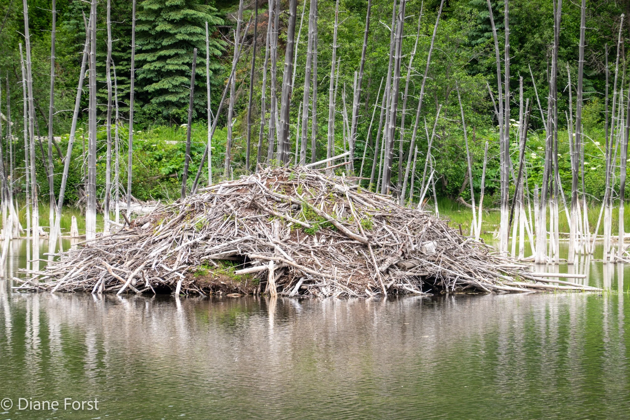
Beaver den, The Green Bowl lake, Murray River Forest Service Road, British Columbia, Canada
Along the shores of The Green Bowl lake we spotted these moose tracks, or at least what we believe are moose tracks.

Moose tracks, The Green Bowl Lake, Murray River Forest Service Road, British Columbia, Canada
Then on the drive back to the campground we finally spotted some actual moose.

Moose, Murray River Forest Service Road, British Columbia, Canada
After returning to Tumbler Ridge we visited the Tumbler Ridge Museum & Dinosaur Discovery Gallery. Inexpensive to get in to for those of us who received the senior discount.
Dinner of New York strip steak with sautéed onions and mushrooms and a spinach salad was delicious.

Lions Flatbed Campground, Tumbler Ridge, British Columbia, Canada
In total our day trip today was 85 miles/137 km almost all of which was driving out to Kinuseo Falls and back.
Sunset at Lions Flatbed Creek Campground this evening was 9:47 PM
Please see the journal posting “2024 Alaska Road Trip (Week 2)” for the next part of the trip.